-
~37,000+ years ago
The ancient landslide forms
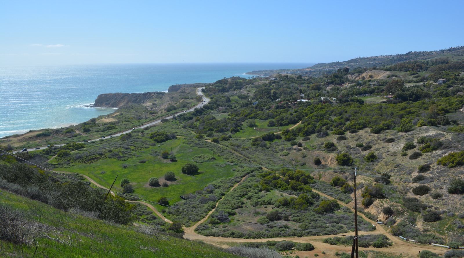
Massive prehistoric sliding creates a roughly two-square-mile landslide complex on the peninsula's south flank. It eventually goes dormant, leaving hummocky terrain later called Portuguese Bend.
-
1862–1885
How Portuguese Bend got its name
After the San Pedro Bay whaling station on Deadman's Island closes, Azorean captain José Machado brings shore whaling to the bend in the coastline north of the bay. For two decades, Portuguese crews row out through the surf to harpoon passing gray whales, tow them ashore, and render the blubber in iron try-pots — one captain alone producing 2,166 barrels of whale oil from 1874 to 1877. Petroleum kills the trade by 1885; the last try-pots and crumbling furnaces vanish by about 1928. The station's site — California Historical Landmark #381, marked along Palos Verdes Drive South — lies within today's slide zone, where the ground has since traveled hundreds of feet seaward: whaling gave this coast its name, and the landslide has been rearranging the ground it stood on ever since.
History: Palos Verdes Library District · Historical Marker Database (CHL #381).
-
1948
A beachfront paradise at Portuguese Bend
The Palos Verdes Corporation opens the Portuguese Bend Club on 105 oceanfront acres — a private beach colony envisioned by Kelvin Vanderlip (son of peninsula founder Frank Vanderlip) with a clubhouse, restaurant, swimming pool, paddle-tennis courts, rental cottages, boating facilities, and a 485-foot pier reaching into the cove. It becomes one of the South Bay's most popular seaside destinations, hosting dances, swim meets, and tournaments. It has eight years left.
Historic photos: Palos Verdes Library District local history collection.
-
1956
Reactivation
During extension of Crenshaw Boulevard, Los Angeles County crews place over 300,000 cubic yards of fill on the head of the ancient slide. The eastern portion reactivates. Roughly 130 homes are ultimately destroyed or removed in the Portuguese Bend community, and litigation against the County follows. The slide also kills the Portuguese Bend Club in its prime: the clubhouse, restaurant, and pool are destroyed as the ground beneath them breaks apart and rafts toward the sea, and the pier and beach colony's glory days end with them (a private beach club community survives at the site today). The land has not stopped moving since — over the following decades it carries the ground hundreds of feet seaward.
The 1956 slide also breaks a water line — beginning a lesson the peninsula has relearned ever since: buried pipes and moving ground don't mix, and leaking lines feed the very slide that breaks them. In the moving area, utilities have long been adapted to flex — including water lines run above ground on flexible connections, a decades-old Portuguese Bend practice that Cal Water dramatically expanded across the complex in 2024 (see below).
-
1974
Abalone Cove begins to move
A second lobe of the ancient complex, west of Portuguese Bend, starts sliding — threatening homes above Abalone Cove and Palos Verdes Drive South.
-
1980–1981
Klondike Canyon awakens; abatement districts form
The Klondike Canyon slide begins moving near the Seaview neighborhood. Under California's Beverly Act, property owners form two Geologic Hazard Abatement Districts — ACLAD (Abalone Cove, 1981) and KCLAD (Klondike Canyon, 1981) — to fund and operate dewatering wells and drainage. Early dewatering succeeds in dramatically slowing Abalone Cove.
-
1999
Ocean Trails: a golf hole falls into the sea
On June 2, 1999 — weeks before the new Ocean Trails Golf Club east of the Portuguese Bend complex was to open — a slice of coastal bluff roughly 600 feet long and 220 feet wide gave way, dropping most of the 18th hole's fairway and green toward the ocean and snapping a 27-inch county sewer main, which spilled raw sewage onto the beach below. The failure occurred on a lobe of ancient landslide ("Landslide C") beneath the course; its trigger was disputed in years of litigation — the developers pointed to leaking buried pipes, others to the ancient slide plane itself. The landslide bankrupted the project, and in November 2002 Donald Trump bought the course for $27 million, rebuilt the 18th hole, and reopened it as Trump National Golf Club Los Angeles. A separate slide from the Portuguese Bend complex — but the same geology, and another chapter in the peninsula's long argument between water, pipes, and ancient slide planes.
Background: Trump National Golf Club Los Angeles (Wikipedia) · CBS News (1999) · South Bay History.
-
2002–2009
The Monks lawsuit: courts force open the moratorium
The City's landslide moratorium, first adopted in 1978, barred new homes across the moving area — including "Zone 2," a portion of the ancient slide above Abalone Cove that had shown little modern movement. In 2002, after minor movement nearby, the City Council effectively froze Zone 2 development with a resolution requiring owners to prove a new home would not aggravate any existing geologic condition — a bar owners called impossible to clear. Sixteen lot owners sued, and in 2008 the California Court of Appeal ruled in Monks v. City of Rancho Palos Verdes that the moratorium as applied was a regulatory taking of the plaintiffs' property. In 2009 the City amended its code to let the "Monks lots" develop, and homes were subsequently built in Zone 2 — several owners had obtained entitlements by 2012.
The arc closed in 2025: after the 2023–24 acceleration redrew the map of what this ground can do, Ordinance 692 permanently banned new residential construction throughout the complex — the restriction the courts had once forced the City to loosen, reimposed by the land itself.
Case background: City of RPV — Zone 2 / Monks lots · case summary.
-
1950s–2010s
Decades of creep and management
Portuguese Bend creeps on — bending Palos Verdes Drive South, which the City repairs continuously. The City adopts a landslide moratorium restricting new development in the moving area, studies remediation options, and installs GPS monitoring. Movement waxes with wet winters and wanes with dry ones.
-
2023
Record rains change everything
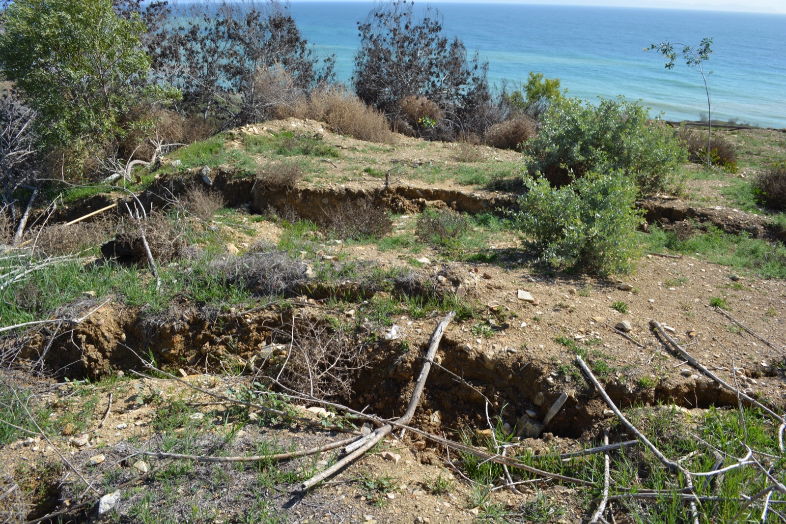
Historic storms saturate the peninsula. Movement accelerates across the complex; fissures open in the Portuguese Bend Reserve; the City declares a local emergency and begins winterization measures.
-
2024
The fastest movement ever recorded
The four slides begin moving as one broad mass across ~700 acres — in places several inches per week, with NASA/JPL radar measuring up to ~4 inches per week in residential areas that fall. The Wayfarers Chapel closes in February and is dismantled for preservation by September. Power is cut to about 245 homes and gas to entire neighborhoods. The shifting ground also breaks buried utility lines over and over — including pressurized water mains and private service lines, whose leaks put still more water into a slide already driven by groundwater. Cal Water responds by rebuilding the system in the open: during 2024 its crews install above-ground water mains with flexible swing joints through most of the Portuguese Bend community, western Seaview, stretches of Palos Verdes Drive South, and part of the Beach Club — the pipes still visible along roadways today, where leaks can be spotted immediately and the lines adjusted as the land moves. FEMA and Cal OES announce a $42 million voluntary buyout program in October. Deep dewatering wells begin pumping at the slide's toe. And at the shoreline, the slide does something almost unbelievable: the advancing toe shoves the seafloor upward, raising hundreds of feet of new rocky land out of the surf below Portuguese Bend — "landslide debris... being pushed up and out of the ocean," in the city geologist's words, visible in before-and-after photos just months apart.
The new shoreline: CBS Los Angeles (July 2024) · L.A. Times via Coastal Care.
-
2025
The slowdown
Dewatering removes hundreds of millions of gallons; movement decelerates sharply. Seaview and the Beach Club effectively stop moving; gas restoration begins in Seaview; the City's $2.8M financial assistance program pays out to 223 households; seven additional wells are installed with ACLAD and KCLAD; the ~$33M remediation project moves through environmental review. In August, Ordinance 692 makes the construction restrictions permanent — no new residential construction in the complex (~400 homes and ~130 vacant lots), replacing the emergency moratorium in place since 2023.
-
2026
Slower — but not stopped
By July 2026 the complex is moving 60% slower than a year earlier, averaging about 1.1 inches per week in the still-active interior, and dewatering passes half a billion gallons removed. Buyouts inch forward awaiting FEMA awards, the Council advances work on a possible third abatement district for Portuguese Bend, and in August it renews the local emergency and extends the home-stabilization ordinance through 2028. The emergency — and the management effort — continues.



.jpg)